Launch Watch · Current evidence
Published
NASA’s Madagascar photo: the viewing angle behind the bright rocks
An original calculation from NASA’s astronaut-photo metadata places the scene about 56 degrees off nadir, with clear limits on measuring the image.
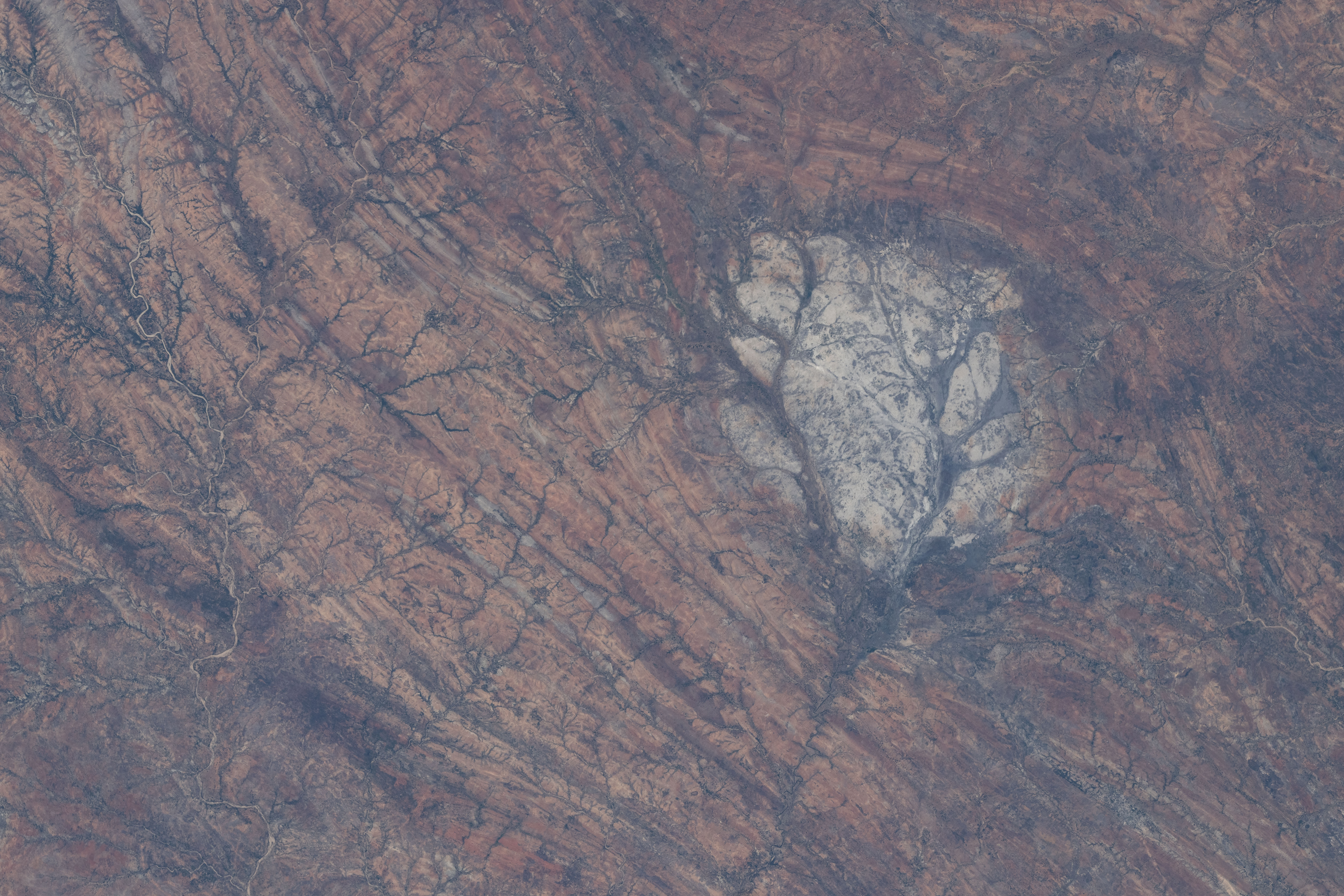
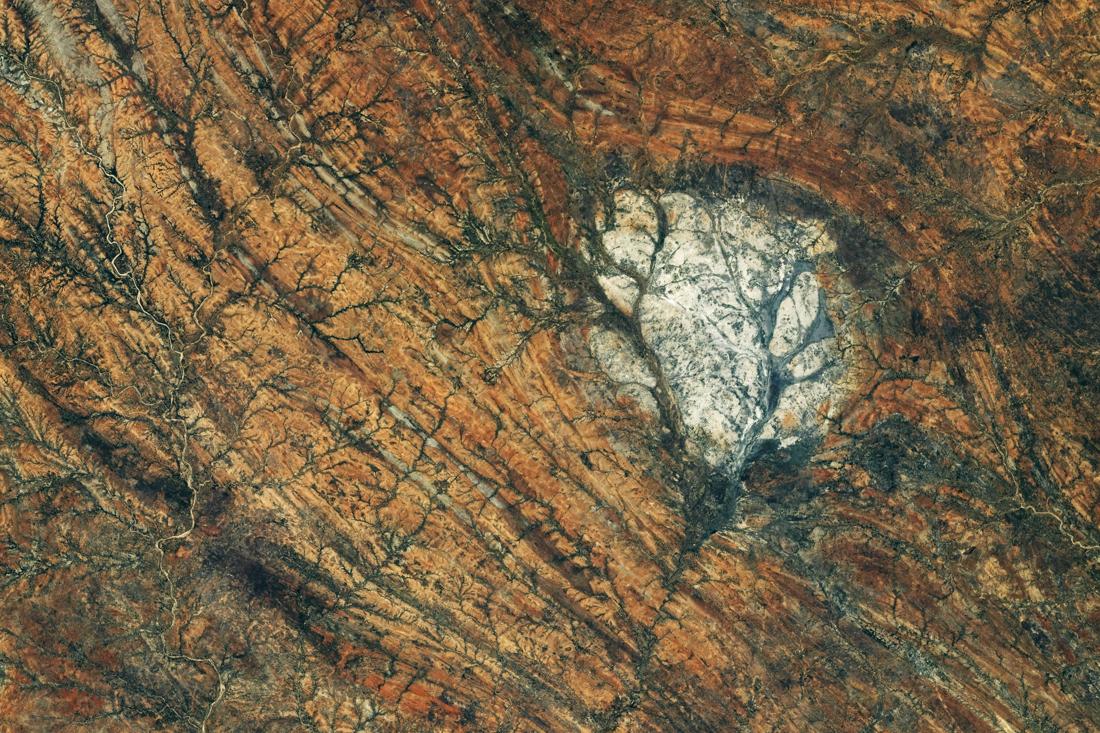
The bright rock in NASA’s October 5 Madagascar image is striking. Its viewing angle is less obvious. The original astronaut-photo record places the estimated scene center roughly 687 kilometers along Earth’s surface from the point directly below the spacecraft. That result, calculated from the record’s rounded coordinates, helps explain why a 400-millimeter lens label alone cannot turn this photograph into a measured map.
NASA identifies the feature as the Saririaky anorthosite massif in southern Madagascar. Anorthosite is also found in the Moon’s bright highlands, which gives the new image its lunar connection. The Earth Observatory story draws on geological research for that identification and for its estimate that the exposed massif covers about 100 square kilometers. We have not derived either the rock type or the area from the image’s colors.
The frame ID connects the new story to an older observation
The source record for ISS075-E-85249 dates the exposure to August 28, 2026, at 08:14:54 GMT. NASA’s story appeared October 5. Those dates answer different questions: when the light reached the camera, and when the image was presented to readers.
| Field | Value | How to use it |
|---|---|---|
| Frame | ISS075-E-85249 | Stable link between photograph and metadata |
| Acquisition time | August 28, 2026, 08:14:54 GMT | Observation time |
| Focal length | 400 mm | Camera optics metadata |
| Spacecraft altitude | 424 km | Displayed altitude, rounded |
| Spacecraft nadir | 29.4° S, 49.0° E | Point below the spacecraft |
| Photo center | 24.44° S, 44.86° E | Explicitly machine-learning derived |
| Manual center and camera tilt | No values in the inspected fields | Do not treat blank fields as measured zero |
The distinction between the nadir and the photo center matters. Nadir is the point directly below the spacecraft. The listed scene center is elsewhere, and the record explicitly identifies it as machine-learning derived. It is a useful approximate location, with no accuracy bound supplied in the inspected record.
An approximate view from 424 kilometers up
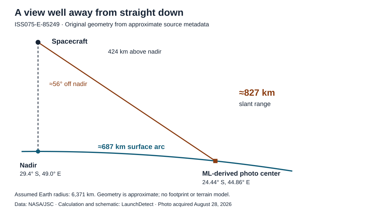
We used those two positions and the displayed altitude in a spherical-Earth calculation, assuming a radius of 6,371 kilometers and treating the scene center as lying on that sphere. The resulting central angle is about 6.18 degrees. Multiplying that angle in radians by the radius gives a ground arc of about 687 kilometers.
| Quantity | Approximate result | Meaning |
|---|---|---|
| Surface arc | 687 km | Distance along the assumed sphere, nadir to estimated center |
| Slant range | 827 km | Straight-line spacecraft-to-estimated-center distance |
| Off-nadir angle | 56° | Calculated look direction relative to straight down |
| Earth central angle | 6.18° | Angle between the two surface positions at Earth’s center |
The slant range is almost twice the displayed altitude. A camera looking well away from nadir sees the ground at an oblique angle, so altitude alone is an incomplete guide to image scale. The calculated 56-degree angle describes our model geometry; it does not fill in the source record’s blank camera-tilt field.
What is still missing for a pixel-area measurement?
A point at the image center does not specify all four image corners, the full camera orientation or the terrain under every pixel. A precise footprint would require more information and a geolocation model suited to the camera and landscape. This record therefore supports an illustrative viewing triangle, not a surveyed boundary around the bright outcrop.
The public image has also been prepared for viewing. NASA says it adjusted contrast, removed lens artifacts and cropped the image. Our downloaded original and editorial files both have dimensions of 8,256 by 5,504 pixels. Equal pixel dimensions do not establish that the content is untouched: cropping and subsequent processing need not leave a smaller final file.
For this reason, counting bright pixels would combine several unresolved choices: a brightness threshold, editorial processing, the geological boundary and the ground area represented by each pixel. No area, absolute reflectance or mineral composition is measured here. NASA’s geological interpretation remains attributed to NASA and its cited research.
Reproduce the viewing triangle
The input CSV preserves the two latitude–longitude pairs, altitude and assumed Earth radius. The calculation CSV gives the resulting surface arc, slant range and angles at full computational precision. Extra decimal places document the arithmetic, without improving the accuracy of the rounded and estimated inputs.
First calculate the central angle between the two positions on a sphere. The surface distance is the radius multiplied by that angle in radians. For the slant distance, apply the cosine rule to the triangle with sides equal to the Earth radius and Earth radius plus spacecraft altitude. The off-nadir angle follows from the same triangle. Terrain, Earth’s ellipsoidal shape and uncertainty in the ML center are outside this simple model.
The result gives the photograph a more informative context: a long-lens view taken substantially away from the point below the station, presented weeks later as an edited image. It makes the image easier to interpret while leaving the geological measurements to evidence that can support them.