Launch Watch · Dashboard evidence
Correction prepared .
Published
Three detections, two launch sites: keep every event on the map
A three-record LaunchDetect snapshot shares two coordinate pairs. Trace an order-dependent overwrite and preserve every event ID in a grouped site inventory.
Three published detection records can legitimately share two map locations. In LaunchDetect’s public index generated on 5 October 2026 at 02:27:53 UTC, USSF-385 and Starlink Group 15-27 have different event IDs and detection dates, but the same published launch-site coordinates. Gravity-1’s SpaceSail Polar Group #16 record supplies the second coordinate pair.
For an export, keep those three event identities even if the map groups them into two site markers. This small snapshot makes the distinction testable: a deliberately faulty transformation that keeps one record per coordinate pair discards an event, and reversing the input changes which event disappears. That result comes from the local transformation; no dashboard data-loss bug or marker-rendering failure was observed.
Count the records before grouping the locations
The public detection index is a changing feed. The retained response used here has three records, three distinct IDs and two exact coordinate pairs. Its stated window runs from 5 September 2026 at 02:27:53 UTC to 5 October at the same UTC time. It reports count 3, total 3, limit 100 and truncated false. Those fields describe this response, rather than all launches worldwide or every historical event at either site.
| Mission and stable event ID | Recorded detection, UTC | Published site and coordinates |
|---|---|---|
| USSF-385 ld-dbd773dda2e52ceb | Space Launch Complex 4E 34.632, −120.611 | |
| Starlink Group 15-27 ld-2e02795321550893 | Space Launch Complex 4E 34.632, −120.611 | |
| Gravity-1 / SpaceSail Polar Group #16 ld-b422ae608744b6bf | Yellow Sea (launch location 5) 31.2, 123.7 |
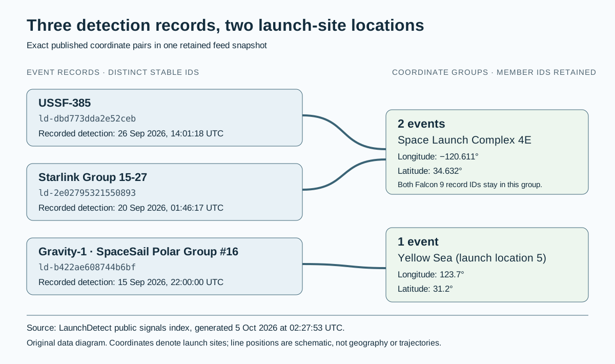
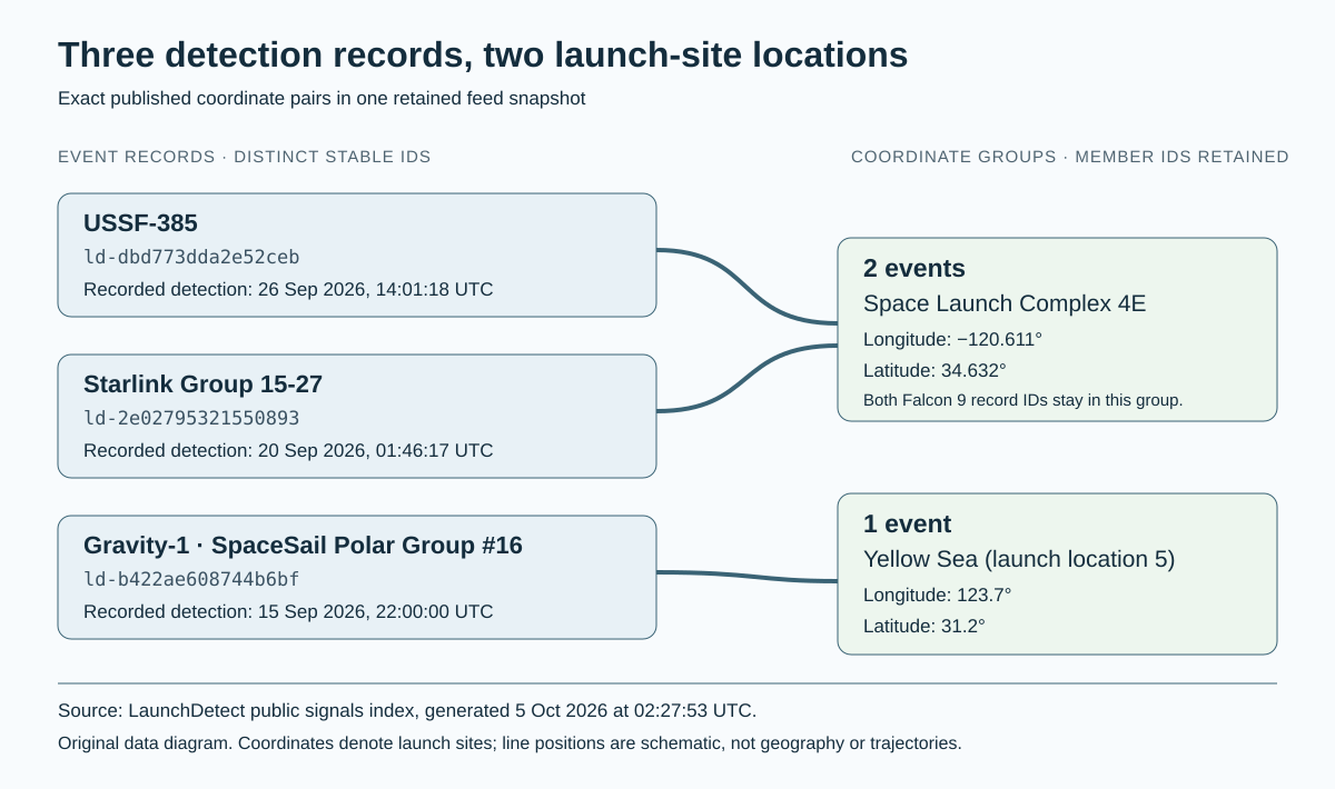
LaunchDetect’s free detection API guide defines these positions as launch-site coordinates. They do not locate a plume pixel, impact point or rocket trajectory. This exercise compares the numeric pairs exactly as published, without additional rounding or a distance threshold. Equal coordinates are useful for this grouping; they are not event deduplication keys or a universal physical-site identity rule. The decimal places establish no positional-accuracy result.
A coordinate-key overwrite changes with input order
Consider a dictionary whose key is the longitude–latitude pair and whose value is a single event record. Assigning a second record to an existing key replaces the earlier value. The source order is USSF-385, Starlink Group 15-27, then Gravity-1. Reversing that order leaves the coordinates untouched but changes which Falcon event survives.
| Input order | Records retained | Falcon record retained | Record discarded |
|---|---|---|---|
| Source order | 2 of 3 | Starlink Group 15-27 | USSF-385 |
| Reversed source order | 2 of 3 | USSF-385 | Starlink Group 15-27 |
Gravity-1 remains in both outputs because its pair is different. Calling either two-record output “deduplicated detections” would conceal the lost identity. Download both overwrite results, including the retained and discarded IDs.
Keep an event view and a grouped site view
An event-level output keeps one row or feature per stable event ID: three in this case. In GeoJSON, each event can retain its own feature ID and properties while two features share a Point geometry. RFC 7946 specifies longitude before latitude for coordinate arrays, so the shared pair becomes [−120.611, 34.632], reversing the table’s labeled column order.
A site-grouped output has two rows or features. Each group keeps its event count, member IDs and member records. Space Launch Complex 4E has two members; Yellow Sea launch location 5 has one. Download the three-event inventory and the two-group inventory to compare those counting units directly.
Two checks protect the aggregation:
- Add the group counts: 2 + 1 = 3, matching the input record count.
- Flatten the group membership lists and compare IDs, including multiplicity, with the input. All three source IDs must appear exactly once; a matching total alone could hide a duplicated member and a missing one.
Both checks pass for the grouped output. For a map interface, a labeled member list or linked table can expose every event at a shared site without changing its coordinates. These are interface recommendations, not claims about a feature tested in the current dashboard.
Sources and reproduction
The analysis starts from the retained public index and independently recomputes its counts, both overwrite experiments and count-preserving event and site outputs. The CSVs retain the original mission labels, coordinates and IDs. The source’s generated-at time is not an exact client receipt timestamp. The feed can change after this snapshot.
- LaunchDetect public detection index: record fields and response window, generated 5 October 2026 at 02:27:53 UTC.
- LaunchDetect API guide and published OpenAPI contract: field meanings and export context.
- GeoJSON specification, sections 3.1.1–3.3: coordinate order, features and feature collections.
The useful result is a reconciled inventory: three published event identities, two exact site-coordinate groups and no discarded member. It supports neither a global launch count nor a detector-performance claim.